UAV-derived estimates of forest structure to inform ponderosa pine forest restoration

Abstract
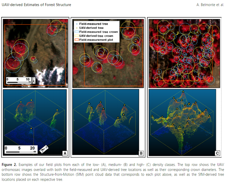
Restoring forest ecosystems has become an increasingly high priority for land managers across the American West. Millions of hectares of forest are in need of drastic yet strategic reductions in density (e.g., basal area). Meeting the restoration and management goals requires quantifying metrics of vertical and horizontal forest structure, which has relied upon field-based measurements, manned airborne or satellite remote sensing datasets. We used unmanned aerial vehicle (UAV ) image-derived Structure-from-Motion (SfM) models and high-resolution multispectral orthoimagery in this study to quantify vertical and horizontal forest structure at both the fine- (<4 ha) and mid-scales (4-400 ha) across a forest density gradient. We then used these forest structure estimates to assess specific objectives of a forest restoration treatment. At the fine-scale, we found that estimates of individual tree height and canopy diameter were most accurate in low-density conditions, with accuracies degrading significantly in high-density conditions. Mid-scale estimates of canopy cover and forest density followed a similar pattern across the density gradient, demonstrating the effectiveness of UAV image-derived estimates in low- to medium-density conditions as well as the challenges associated with high-density conditions. We found that post-treatment conditions met a majority of the prescription objectives and demonstrate the UAV image application in quantifying changes from a mechanical thinning treatment. We provide a novel approach to forest restoration monitoring using UAV -derived data, one that considers varying density conditions and spatial scales. Future research should consider a more spatially extensive sampling design, including different restoration treatments, as well as experimenting with different combinations of equipment, flight parameters, and data processing workflows.